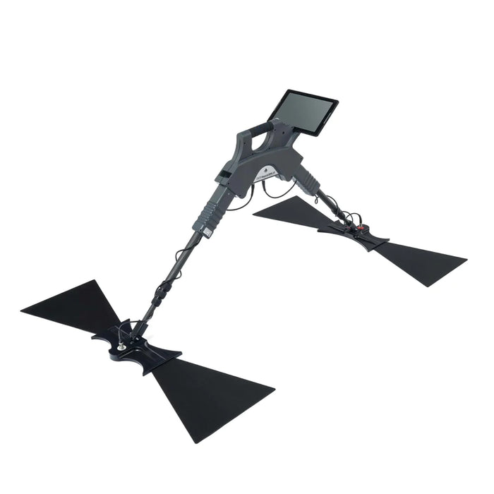
OKM Gepard GPR 3D
✔ Price Match Guarantee
✔ Ships in 1-2 Business Days
✔ Unlimited After-Sales Support
First-time customers get 5% off with code "FIRST5" at checkout

✔ Price Match Guarantee
✔ Ships in 1-2 Business Days
✔ Unlimited After-Sales Support
First-time customers get 5% off with code "FIRST5" at checkout
This Ground Penetrating Radar (GPR) system is engineered for the flexible and powerful detection of subterranean objects and structures, allowing land surveying to explore ground conditions.
Depth and Precision
Equipped with an omnidirectional, unshielded transmission system, the Gepard GPR offers an impressive detection depth of up to 40 meters (132 feet), enabling users to discover objects and anomalies deep underground. Whether it's pipelines, cavities, cables, conduits, tunnels, bunkers, or foundations, this radar can be used in various surveying tasks.
Versatile Use Cases
From uncovering the secrets of ancient civilizations in archaeology to identifying critical infrastructure in geotechnical engineering, the Gepard GPR is a diverse surveying tool.
Advanced Operating Modes
With Ground Scan and Live Stream modes, the Gepard GPR offers flexibility in surveying the land. Switch between modes to suit your specific survey needs and objectives, allowing for efficient and effective ground exploration.
Cutting-edge Technology
This compact unit can be easily operated by a single user via an Android Tablet PC, offering a user-friendly interface and immediate data transfer and visualization. The radar operates on a multiple frequency range from 60 MHz to 300 MHz, facilitated by adjustable telescopic antennas for optimized surveying.
Intelligent Data Analysis
The Android app integration allows for real-time data analysis, with options for GPS signal integration or Google Maps, automatic filtering, and note-taking for detailed recollection of scan specifics. Enhanced by OKM's Visualizer 3D Studio software, users can analyze detected structures in both 2D radargrams and volumetric 3D views, with customizable visualization settings to highlight findings effectively.
Optimized for Excellence
The Gepard GPR adapts to various soil types with its automatic adjustments, simplifying the process for users and maximizing survey accuracy. This feature, combined with the radar's broad detectable object range and depth.
The technical data are average values. Minor deviations are possible during operation.