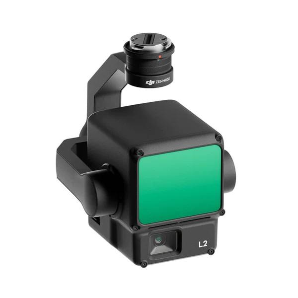
DJI Zenmuse L2 Payload
✔ Price Match Guarantee
✔ Ships in 1-2 Business Days
✔ Unlimited After-Sales Support
Phone: +1 888 850 6533
Mon - Fri: 9 am - 5 pm (MT)
Phone: +1 888 850 6533
Mon - Fri: 9 am - 5 pm (MT)

✔ Price Match Guarantee
✔ Ships in 1-2 Business Days
✔ Unlimited After-Sales Support
The DJI Zenmuse L2 LiDAR payload is designed to enhance aerial surveying and mapping capabilities for your DJI Enterprise drone. It seamlessly integrates with the DJI Matrice 350 and 300 series and with added precision and efficiency. With penetration and the ability to return 5 data points from a single pulse, the Zenmuse L2 shines at capturing critical data under dense canopies and complex structures. Its impressive detection range of 250-450 meters provides the precision and coverage needed for any surveying project.
Advanced LiDAR and Imaging Integration: Frame-Based LiDAR System: The Zenmuse L2 incorporates a state-of-the-art frame LiDAR, a self-developed high-accuracy IMU system, and a 4/3 CMOS RGB mapping camera. This powerful combination provides the capture of precise, detailed geospatial data, suitable for a wide range of applications, including environmental monitoring, urban planning, and infrastructure inspection.
Extended Range and Detection: With a 30% increase in detection range, the L2 is capable of identifying objects from 250 meters at 10% reflectivity and up to 450 meters at 50% reflectivity, significantly enhancing surveying safety and operational efficiency.
Enhanced Point Cloud Density: The smaller laser spot size of 4×12 cm at 100 meters allows the L2 to detect smaller objects with greater detail and penetrate denser vegetation, resulting in denser and more accurate digital elevation models (DEMs).
High-Efficiency Point Cloud Acquisition: Supporting up to 5 returns, the L2 captures more ground points beneath foliage, with an effective point cloud rate of 240,000 points per second. This capability is crucial in densely vegetated areas, ensuring comprehensive ground coverage.
Flexible Scanning Modes for Diverse Applications: Two Scanning Modes: The L2 offers both repetitive and non-repetitive scanning modes, catering to a variety of surveying needs. Repetitive scanning modes provide uniform, high-precision point clouds, ideal for high-accuracy mapping. Non-repetitive scanning mode provides deeper penetration for structural information, making it great for power line inspection and forestry surveying.
Frame-Based Design: Its frame-based design provides an effective point cloud data rate of up to 100%, maximizing data acquisition efficiency. Coupled with a three-axis gimbal, the L2 offers unparalleled flexibility and precision in surveying operations.
Seamless Integration with DJI Terra: When used in conjunction with DJI Terra, the Zenmuse L2 delivers a comprehensive solution for 3D data collection and high-accuracy post-processing. Users can preview, playback, and process point cloud models on-site, with task quality reports generated to improve efficiency and precision in data handling.
Enterprise Care Basic: To provide peace of mind and operational continuity, the Zenmuse L2 comes with Enterprise Care Basic, offering up to two paid replacements within one year after product activation, safeguarding your investment and operations.
General:
System Performance:
LiDAR:
Inertial Navigation System:
Positioning Accuracy:
RGB Mapping Camera:
Gimbal:
Data Storage:
Post-Processing: