DJI Matrice 400 Enterprise Drone (No Batteries / No Care) — My Surveying Direct
  • Complete the Form below to receive a custom quote from our Enterprise Sales team. You'll hear from us typically within the hour.
  • Skip to content
    Free Shipping for the Lower 48 States
    Free USA Shipping (T&Cs Apply)

    DJI Matrice 400 Enterprise Drone (No Batteries / No Care)

    In Stock & Ready To Ship
    Original price $10,450.00 - Original price $10,450.00
    Original price
    $10,450.00
    $10,450.00 - $10,450.00
    Current price $10,450.00

    Price Match Guarantee

    Ships in 1-2 Business Days

    Unlimited After-Sales Support

    • Visa
    • Mastercard
    • American Express
    • Discover
    • Diners Club
    • Google Pay
    • Apple Pay

    ✅ Authorized DJI Enterprise Dealer 🏷️ Best Price Guarantee 🚚 Free Shipping 🛡️ Manufacturer Warranty 🔧 Professional Support

    Long-Endurance Drone Platform With Power-Line-Level Obstacle Sensing

    DJI Matrice 400

    Engineered for Excellence, Designed for Versatility

    Auto-playing on loop

    Overview

    DJI Matrice 400, the enterprise flagship drone platform, boasts an impressive 59-minute flight time, a payload capacity of up to 6 kg, and integrated rotating LiDAR and mmWave radar for power-line-level obstacle sensing. It also supports the O4 Enterprise Enhanced Video Transmission and Airborne Relay Video Transmission, ensuring safer handling and easier operations. Combining Smart Detection with visible and thermal imaging, AR projection, ship-based takeoff/landing, and advanced automation, Matrice 400 excels in emergency response, power inspections, mapping, and AEC.


    Safe and Reliable Flight

    IP55 protection rating for operation in challenging conditions including heavy dust or rain. Stable performance from -20° to 50° C.


    Power-Line-Level Sensing

    Advanced obstacle sensing with rotating LiDAR, mmWave radar, and fisheye vision sensors detect even small obstacles like power lines.


    Robust Video Transmission

    O4 Enterprise Enhanced Video Transmission System with up to 40 km range and sub2G frequency band support.


    Airborne Relay Transmission

    Built-in video transmission relay module allows one drone to serve as a relay for another, extending range significantly.


    Aircraft Fusion Positioning

    Omnidirectional sensing provides strong positioning capabilities even near glass buildings or wind turbines.


    Full-Color Vision Assist

    Four full-color low-light fisheye vision sensors ensure safer flight in various lighting conditions.

    Key Features

    Extended Flight Time, High Speed Performance

    Matrice 400's flight capabilities are outstanding, offering up to 59 minutes of forward flight time even with a payload, and up to 53 minutes of hovering duration. These capabilities make it a reliable tool for long-duration and continuous operations such as search and rescue, firefighting, and large-scale mapping. It can also avoid large obstacles like buildings and mountains at flight speeds of up to 25 m/s.

    DJI Matrice 400 Flight Performance

    Multi-Payload, Multi-Scene

    Matrice 400's strong payload capacity allows it to easily meet the demands of a wide range of applications. With a maximum payload capacity of 6 kg, Matrice 400 supports seamless switching between a single downward gimbal and a dual downward gimbal. It also features a third gimbal connector on the underside for additional flexibility. The aircraft is equipped with 4 external E-Port V2 ports, enabling simultaneous mounting of up to 7 payloads.

    DJI Matrice 400 Payload Capacity

    Enhanced Intelligence and Efficiency

    Smart Detection

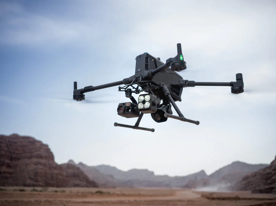
    With Zenmuse H30 Series' visible and thermal imaging, Matrice 400 can detect vehicles, vessels, and subjects during search and rescue operations or routine flights. It also supports switching to other models, enabling the expansion of application scenarios. Additionally, it supports high-res grid photos and features powerful tracking capabilities.

    Real-Time Terrain Follow

    Matrice 400 supports Real-Time Terrain Follow flight in any horizontal direction. This feature can be enabled during both manual flight and automated flight routes, ensuring stable relative height to the ground.

    During large-scale search and rescue operations, the size of ground subjects can be kept consistent on the remote controller screen, reducing the need for frequent zoom adjustments and improving efficiency. During mapping missions, a consistent ground sampling distance (GSD) can be maintained to obtain high-precision mapping data.

    Takeoff and Landing on Ships

    To address the needs of offshore operations such as maritime patrol and wind turbine inspection, Matrice 400 is equipped with the capability to take off from and land on ships, supporting takeoff from stationary vessels and landing on moving vessels. By detecting landing point patterns on the deck, it can achieve safe and precise landings.

    Easier Automated Operations

    When equipped with the L2 LiDAR system, Matrice 400 can perform automated power transmission and distribution line following flights. It uses the rotating LiDAR to detect obstacles in real time and automatically bypasses crossing lines.

    Matrice 400 supports the planning and execution of slope and geometric routes via DJI Pilot 2 or DJI FlightHub 2. Whether conducting detailed aerial surveys of building facades, slopes, or other inclined surfaces, or collecting mapping data of individual buildings or structures, Matrice 400 can quickly plan slope or geometric routes to efficiently acquire high-precision data.

    Specifications

    Key Specifications

    Max Flight Time 59 minutes
    Max Hover Time 53 minutes
    Max Payload Capacity 6 kg
    Max Horizontal Speed 25 m/s
    Max Takeoff Weight 15.8 kg
    Operating Temperature -20° to 50° C
    Ingress Protection IP55
    Transmission & Sensing

    Video Transmission System O4 Enterprise Enhanced
    Max Transmission Distance 40 km (FCC)
    Sensing System Rotating LiDAR, mmWave radar, Vision sensors
    Obstacle Sensing Omnidirectional
    GNSS GPS + Galileo + BeiDou + GLONASS*
    Hovering Accuracy (RTK) ±0.1 m vertical/horizontal
    Full Technical Specifications

    Aircraft

    Takeoff Weight (with propellers) Without Batteries: 5020±20 g
    With Batteries: 9740±40 g
    Max Takeoff Weight 15.8 kg
    Dimensions Unfolded: 980×760×480 mm (L×W×H) (with landing gear)
    Folded: 490×490×480 mm (L×W×H) (with landing gear and gimbal)
    Max Payload 6 kg
    Propeller Size 25 inches
    Diagonal Wheelbase 1070 mm
    Max Ascent Speed 10 m/s
    Max Descent Speed 8 m/s
    Max Horizontal Speed (at sea level, no wind) 25 m/s
    Max Takeoff Altitude 7000 m
    Max Flight Time (no wind) 59 minutes
    Max Hover Time (no wind) 53 minutes
    Max Flight Distance (no wind) 49 km
    Max Wind Speed Resistance 12 m/s
    Max Yaw Angular Velocity Yaw: 100°/s
    Max Pitch Angle 35°
    Operating Temperature -20° to 50° C (-4° to 122° F) (without solar radiation)
    Global Navigation Satellite System (GNSS) GPS + Galileo + BeiDou + GLONASS*
    Hovering Accuracy Range (with moderate or no wind) Vertical:
    ±0.1 m (with vision positioning)
    ±0.5 m (with satellite positioning)
    ±0.1 m (with RTK positioning)

    Horizontal:
    ±0.3 m (with vision positioning)
    ±0.5 m (with satellite positioning)
    ±0.1 m (with RTK positioning)
    RTK GNSS Accuracy RTK Fix:
    1 cm + 1 ppm (horizontal), 1.5 cm + 1 ppm (vertical)
    RTK Heading Supports RTK heading with an accuracy better than 2°
    Airborne ADS-B In Equipped with standard airborne ADS-B In receiver and dual antennas, supporting reception up to 20 km.
    Internal Storage N/A
    Ports USB-C Debug Port × 1: USB 2.0
    E-Port V2 × 4: At the lower part of the drone, with 120W single-port power
    Cellular Dongle 2 Interface × 2: On the underside of the drone
    Propeller Model 2510F
    Beacon Built into the aircraft
    Ingress Protection Rating IP55

    Gimbal

    Maximum Payload for Single Gimbal Connector 1400 g
    Maximum Payload for Dual Gimbal Connector 950 g
    Maximum Payload for Third Gimbal Connector 3 kg for quick-release port, 6 kg for screw lock fastening

    Sensing

    Sensing Type Omnidirectional binocular vision system (surround view provided by full-color fisheye vision sensors)
    Horizontal rotating LiDAR, upper LiDAR and downward 3D infrared range sensor
    Six-direction mmWave radar
    Forward Measurement Range: 0.4-21 m
    Detection Range: 0.4-200 m
    Field of View (FOV): 90° (horizontal), 90° (vertical)
    Backward Measurement Range: 0.4-21 m
    Detection Range: 0.4-200 m
    Field of View (FOV): 90° (horizontal), 90° (vertical)
    Lateral Measurement Range: 0.6-21 m
    Detection Range: 0.5-200 m
    Field of View (FOV): 90° (horizontal), 90° (vertical)
    Downward Measurement Range: 0.5-19 m
    The FOV to the front and rear is 160° and 105° to the right and left.
    Rotating LiDAR Standard Measurement Range: 0.5-100 m @ 100,000 lux with 10% reflectivity target
    Measurement Range for Power Line: 35 m @ 30° @ 10,000 lux for 21.6 mm steel-core aluminum stranded wire with a relative body tilt angle of 30° to the left and right
    Field of View (FOV): 360° (horizontal), 58° (vertical)
    Point-Frequency: 520,000 points/second
    Laser Wavelength: 905 nm
    Eye Safety Level: Class 1 (IEC60825-1:2014), eye-safe
    Upper LiDAR (3D ToF) 0.5-25 m at night (reflectivity > 10%)
    The FOV to the up and down is 60° and 60° to the right and left.
    Downward 3D Infrared Range Sensor Measurement Range: 0.3-8 m (reflectivity > 10%)
    The FOV to the front and rear is 60° and 60° to the right and left.
    mmWave Radar Measurement Range for Power Line:
    36 m for a 12.5mm steel-core aluminum stranded wire
    50 m for a 21.6mm steel-core aluminum stranded wire
    FOV: ± 45° (horizontal and vertical)

    * The actual product weight may vary due to differences in batch materials and external factors.
    * The 6 kg payload is measured at the third gimbal connector under sea level conditions. Payload capacity decreases as altitude increases. For details, refer to the official user manual.
    * Maximum dimensions excluding propellers.
    * GLONASS is supported only when the RTK module is enabled.
    * The rating is not permanently effective and may decrease due to product wear and tear.
    * If exceeds, the gimbal damper lifespan will decrease from 1000 hours to 400 hours.
    * Sufficient lighting conditions refer to an illuminance not lower than that of a nighttime city light scene.
    * The mmWave radar function is unavailable in some countries/regions.


    Why Shop with Us?

    Quality and Value

    We obsess about quality and value for our customers. All the products that we sell are genuine and in brand-new condition.

    Secure Payments

    We use encrypted SSL security to ensure that your credit card information is protected.

    Free Shipping

    On all orders (lower 48 states).

    30 Days Return Policy

    We accept returns within 30 days of delivery, provided the product is not used and in its original condition.

    You may also like